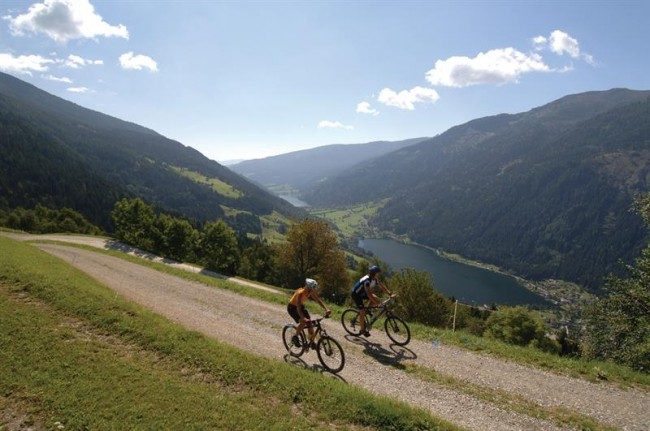
Due to the length it is advisable to divide the path into several stages.
1.Salisburg – Bischofshofen
Length: 55 km; height difference on climb: 480 mt; height difference on descent: 360 mt.
The first stage of the bike lane uses the Tauri cycle track along the Salzach River. Near the city the track is asphalted but once you move away you drive on the dirt road, the trail is still well maintained. From the city of Hallein you will cross many country villages up to Golling. After passing this one you reach the wildest section of the river and you are forced to deviate on the national road. Few kilometers later you arrive at Werfen, a village dominated by an ancient fortress, and then to Bischofshofen.
2.Bischofshofen – Bockstein
Length: 56 km; height difference on climb: 940 mt; height difference on descent: 360 mt.
The cycle path continues through Schwarzach and then climbs into meadows and farms for a rather demanding stretch. After the climb, you leave the cycle track and you enter the valley of the Gastein stream where you begin to ride on the Gasteinertal bicycle path. Initially you cross some well-lighted galleries where the path narrows considerably before returning to open country. Overcoming a village after another you reach Bockstein. From here you need to take the train to arrive at the opposite side of the High Tauern from where the cycle path begins.
Length: 44 km; height difference on climb: 275 mt; height difference on descent: 895 mt.
From the Mallnitz railway station, Alpe Adria Bike Lane reaches the border with the High Tauern National Park and then descends along a scenic traffic road, prohibited to the traffic, to the Möll River. From here, you take the Glockner bicycle path to Möllbrücke, here you follow the Drava course along another beautiful Austrian bicycle path: the Drauradweg. After a few kilometers on plain between fields and meadows you reach Spittal a.d. Drau.
4.Spittal a.d. Drau – Villach
Length: 41 km; height difference on climb: 75 mt; height difference on descent: 170 mt.
From Spittal you continue along the cycle path through the countryside, reaching small towns and small villages centered on agriculture. At Paternion you can choose whether or not to move on the opposite bank of the Drava, you will have to cross again in Grummern to continue along the Alpe Adria Bike Lane. Villach is, at this point, only a few kilometers away, you will notice it immediately after crossing a barrier on the river.
5.Villach – Tarvisio
Length: 36 km; height difference on climb: 355 mt; height difference on descent: 135 mt.
As soon as you leave the town of Villach, you leave the Drava river course to move along the Gail River pedaling in the direction of Italy. You reach the municipalities of Pockau and Arnoldstein at the Austrian border. Before crossing the border you have to face a climb with two challenging hairpin turns that lead into the Tarvisio Forest, in Italian territory. After crossing the villages of Coccau di Sotto and Coccau di Sopra you arrive in the city of Tarvisio.
6.Tarvisio – Pontebbia
Length: 24 km; height difference on climb: 95 mt; height difference on descent: 255 mt.
Along the old pontebbana railway, successfully transformed into an asphalted bike track, you can easily ride from Tarvisio to Camporosso. A small effort is therefore required to reach the 817 mt of the Sella di Camporosso alpine pass, but then the road is all downhill. You cross woods and meadows over the towns of Ugovizza and Malborghetto until they finish the stage at Pontebba.
Length: 38 km; height difference on climb: 170 mt; height difference on descent: 500 mt.
The Alpe Adria Bike Lane continues along the track of the old pontebbana railway for that is perhaps the most beautiful stretch of the whole track. You can pedal easily by crossing bridges, viaducts and tunnels that date back to the end of the 19th century. The track is only 20 km further south where the workers are working on its completion. After a short stretch of the state road you will return to the protected area at Moggio Udinese and continue to Carnia. Few kilometers later we are in Venzone.
8.Venzone – Udine
Length: 56 km; height difference on climb: 200 mt; height difference on descent: 320 mt.
From Venzone you return to the old pontebbana railway, here already completed, leading us to Gemona. You have definitely left the mountains in favor of the sea. Once overtaking the Osoppo plain you enter the Tagliamento Park by pedaling on wide white roads. Near Buja there are some climbs, the last of the route, but once passed you are already in the city. Udine is reached through a series of cycling trails that also pass through the Cormor Park.
9.Udine – Grado
Length: 58 km; height difference on climb: 25 mt; height difference on descent: 145 mt.
A very easy stage that runs completely in plain in the middle of the Friulian countryside. The landscape however does not repeat itself monotonous: it passes from cultivated fields, to areas rich in streams to the lagoon and to sandy beaches near the sea. They cross Palmanova, Cervignano del Friuli and Aquileia and then go to Grado. A refreshing swim in the Adriatic Sea is a must!
